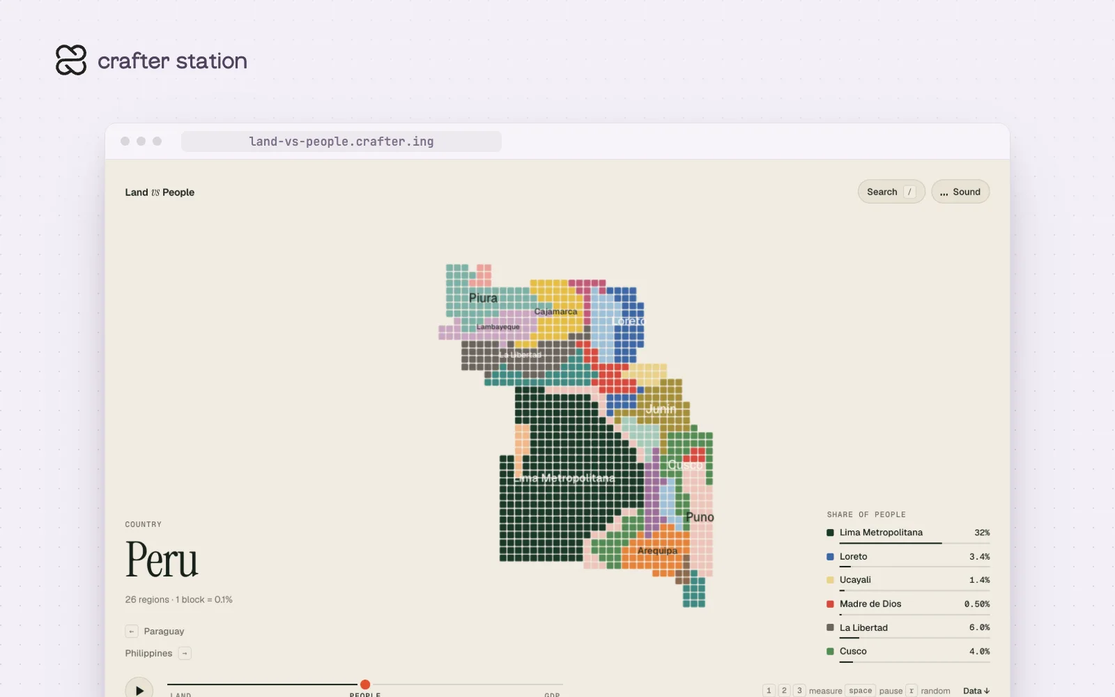
Land vs People draws every country and continent as about 1,000 blocks, then moves the same blocks to show where people live and where the money is. A map by area makes empty places look important, and this one lets you watch the weight shift. It covers 213 places. Open it at land-vs-people.crafter.ing.
Peru, three ways#
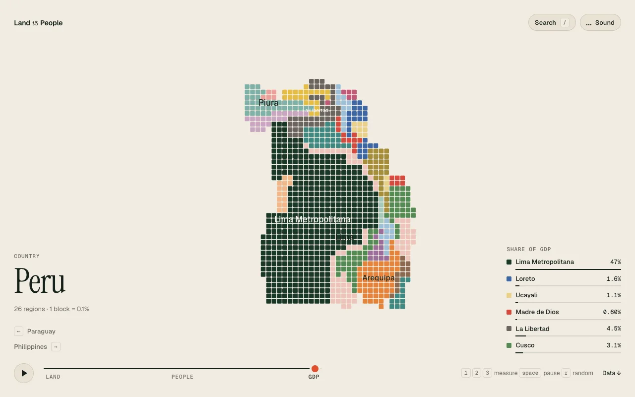
Each block on the Peru map is 0.1% of the country. By land, Lima Metropolitana holds 0.20%. By people it holds 32%, and by GDP 47%. Loreto goes the other way, from 29% of the land to 3.4% of the people and 1.6% of the GDP.
Every place has its numbers#
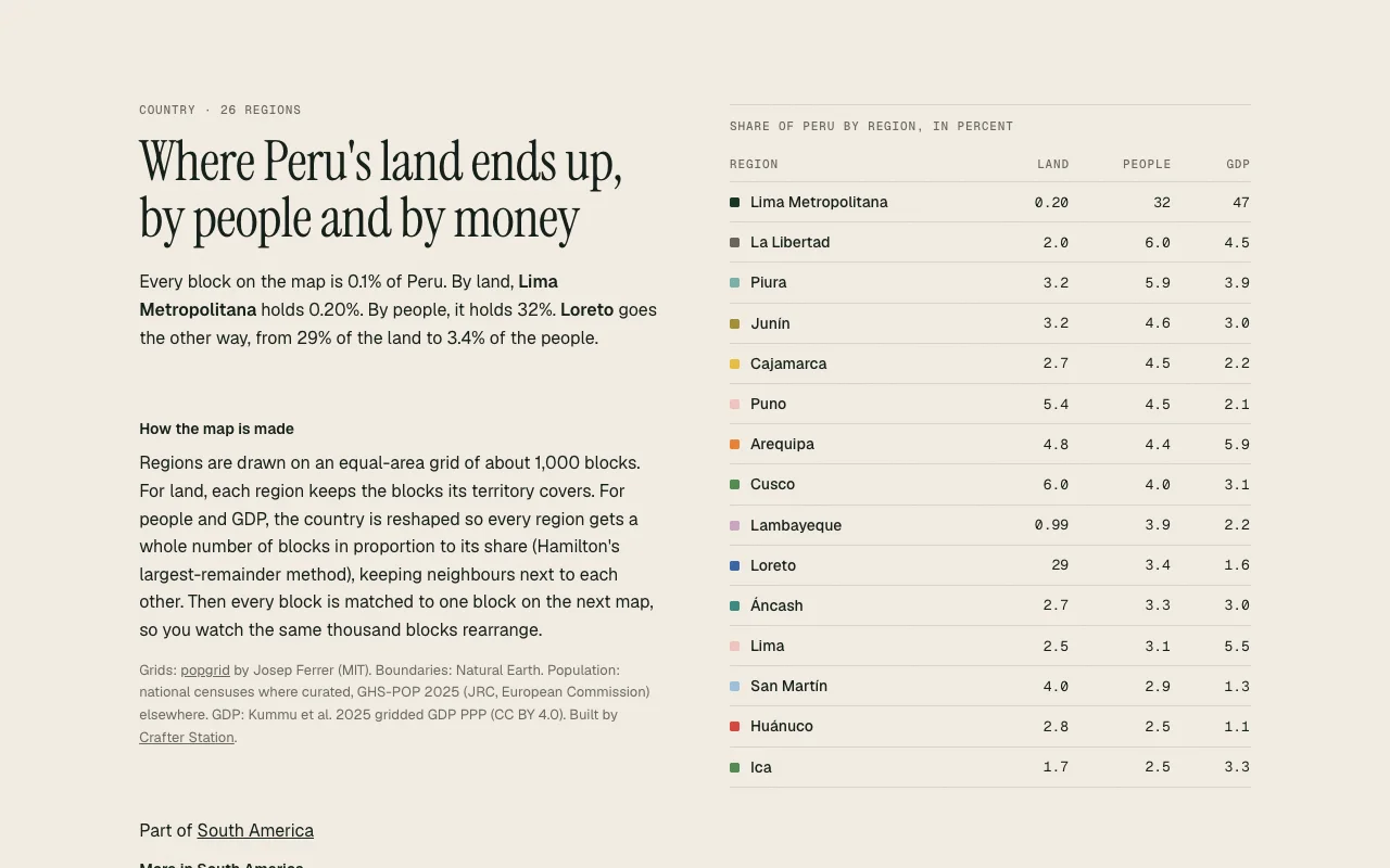
Below the map, each country page lists its regions with their share of land, people and GDP. It also explains how the map is built. Regions sit on an equal-area grid, each one gets a whole number of blocks in proportion to its share, and every block is matched to one block on the next map so neighbors stay together.
Try it#
Open land-vs-people.crafter.ing, press 1, 2 or 3 to switch the measure and space to pause. Press / to search for a place, or go straight to one by its code, such as /per for Peru.
Sources#
- grids from popgrid by Josep Ferrer (MIT)
- boundaries from Natural Earth
- population from national censuses where curated, and GHS-POP 2025 (JRC, European Commission) elsewhere
- GDP from Kummu et al. 2025 gridded GDP PPP (CC BY 4.0)